


morzine col du mont chery

labarone
User
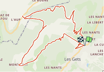

Length
16.6 km

Max alt
1819 m

Uphill gradient
992 m
Km-Effort
30 km

Min alt
1162 m

Downhill gradient
992 m
Boucle
Yes
Creation date :
2024-06-23 07:07:46.513
Updated on :
2024-06-23 13:54:52.648
6h45
Difficulty : Very difficult

FREE GPS app for hiking
 SityTrail
IGN / Geographical institutes
SityTrail Plus
The world is yours!
About
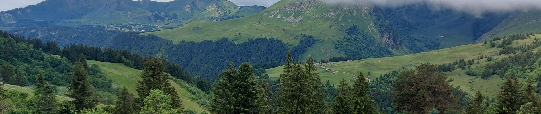
Trail Walking of 16.6 km to be discovered at Auvergne-Rhône-Alpes, Upper Savoy, Les Gets. This trail is proposed by labarone.
Description
bien mais ça monte
Photos


Positioning
Country:
France
Region :
Auvergne-Rhône-Alpes
Department/Province :
Upper Savoy
Municipality :
Les Gets
Location:
Unknown
Start:(Dec)
Start:(UTM)
320164 ; 5114520 (32T) N.
Comments